
From the security belt to the yellow line: Israel’s expanding occupation of southern Lebanon
A comparison of the occupied areas before 2000 and in 2026 reveals a changing map of control, with Israel reoccupying dozens of villages, imposing fire control over additional areas, and transforming the border zone into an uninhabitable strip.



 Messenger
 Whatsapp
 Threads
 Email
Email
 Print
Print
 X
X
 Facebook
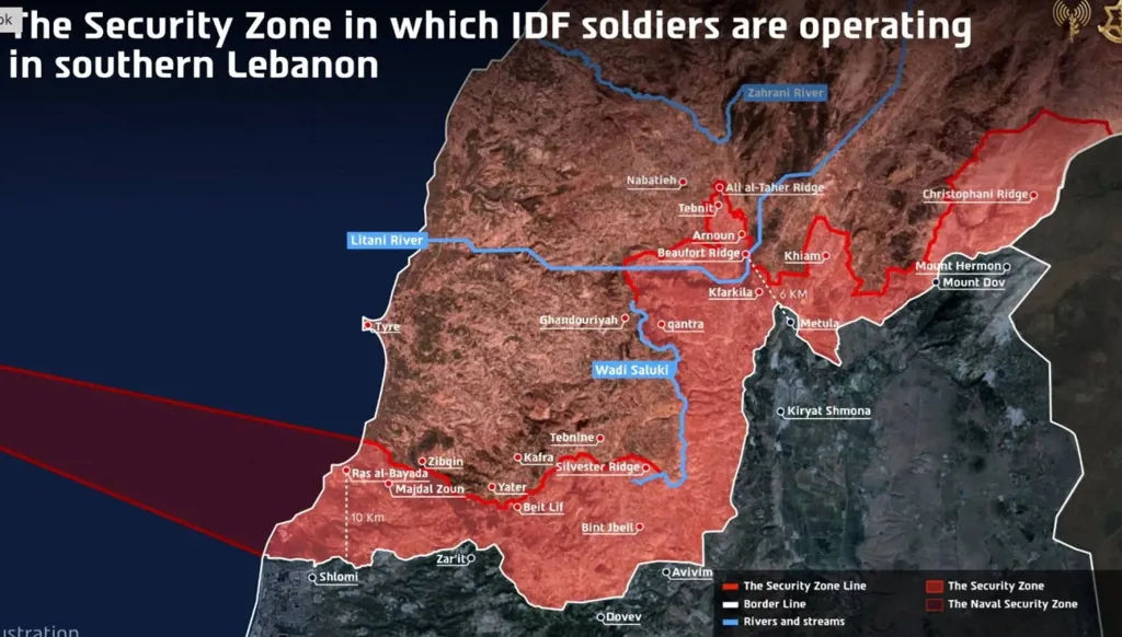


Since the announcement of the first ceasefire between Hezbollah and Israel, the terms of which were published by the U.S. Department of State on April 16, and after the signing of the memorandum of understanding between America and Iran, which included a cease-fire on the Lebanese front, Israel has been solidifying its occupation of extensive regions south of the Litani River. On April 18, the Israeli army announced the establishment of the "Yellow Line", and its expansion to north of the river in certain areas like eastern Zawtar al-Sharqiyah, occupying the Beaufort Castle and Arnoun, Yohmor, and Kfar Tebnit up to the borders of Ali al-Taher Hill in Nabatieh. It also expanded from Majdal Zoun to Mansouri in Tyre district, while maintaining fire control over Froun and Ghandouriyah in the central area.
The Israeli forces began advancing after the ignition of the southern front in the Iran support war initiated by Hezbollah through its missile launch on March 2, 2026. Moving from the five points occupied in 2024 to the border villages in the first and second-line border villages, occupying villages numerous despite fierce confrontations with Hezbollah fighters, demolished houses with shelling and explosions, and turned the towns into uninhabitable zones.
Occupation of 55 Villages and Control Over 11 Towns
Since the beginning of their incursion last March, Israel occupied approximately 55 villages and towns in the south at a depth ranging from 6 to 10 kilometers, integrating them into the "Yellow Line". It then extended its fire control over more than 11 towns, encircled villages in the Hasbaya district, and the Arqoub area in the eastern sector without entering them. These areas nevertheless remain under Israeli control from its positions in the Shebaa farms and Mount Hermon, unlike its occupation before 2000 which had included most of the Hasbaya district.
The occupied strip established during the 2026 war is now referred to as the "Yellow Line," extending up to 10 km deep from the Blue Line established following the Israeli withdrawal in 2000, stretching from Naqoura in the west to the Wazzani in the east. Previously, the area was known as the 'Security Belt' occupied in two phases during the 1978 and 1982 invasions. That occupation lasted for 18 years in areas extending beyond the south of the Litani, including the Jezzine district, Beaufort Castle, and the Ali al-Taher area reaching the outskirts of Kfar Reman and rising towards Al Rihan and Sejoud.
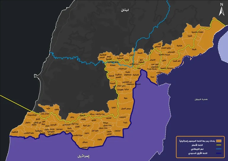
The Phase After 1985
When the Israeli army withdrew from the south in June 1985 following the 1982 invasion, it continued to occupy a wide area of lands, ranging between 8 and 20 km in depth. The area stretched along the international borders from Ras Naqoura in the west to the northeast outskirts of Hasbaya and Kfar Shuba in the east, near the Syrian border, passing through the towns of Bint Jbeil, Marjayoun, Khiam, and Jezzine. The occupied territory covered approximately 1350 km², slightly more than a tenth of Lebanon's total territory.
The "Yellow Line" today roughly corresponds the area Israel occupied in its first invasion in 1978, with some added regions, where it comprised 59 towns, farms, and villages at that time. Following the 1982 invasion and Israel's withdrawal from Sidon and Tyre in 1985, the occupied area expanded to surround 171 towns, farms, and villages, an increase of 112 compared to 1978. Notably, the total population of the occupied strip after 1985 was approximately 350,000 people, although it declined to about one-third in the following years.
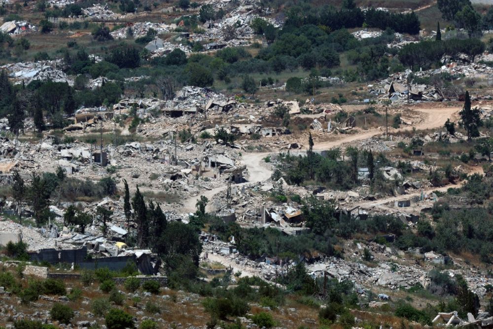
The 2026 occupation
The Israeli occupation in 2026 turned the area within the "Yellow Line" uninhabitable, preventing the return of residents and imposing different realities than the previous occupation.
During the 2026 war, Israel adopted the name 'Yellow Line' for the occupied area south of the Litani, with a depth ranging between 6 and 10 kilometers. This line includes about 55 uninhabited villages, unlike the pre-2000 strip occupation, where they control about 11 villages by fire.
The occupied area in the Tyre district includes towns like: Al-Biyadah, Shemaa, Majdal Zoun, Mansouri, Naqoura, Alma al-Shaab, Tayr Harfa, Jibbeen, Sheihin, Dhahira, Yarin, Marwahin, Bustan, Umm al-Tout, Zaloutiya, and Salhani.
As for the Bint Jbeil district, the occupied towns are: Ayta al-Shaab, Ramyah, al-Qouzah, Dibbal, Ain Ebl, Rameesh, Sarbin, at-Tiri, Hanineh, Rachaf, Yaaroun, Maroun al-Ras, Bint Jbeil, Aitaroun, and Kounine, in addition to Beit Yahoun and Hadatha, noting that the latter was not fully entered by the occupation army but reached some of its neighborhoods. The status of Ghendouria remains unresolved.
In the Marj Ayoun district, Israel occupied villages like: Blida, Muhaybib, Mays al-Jabal, Houla, Markaba, Adaisseh, Kafr Kila, Khiam, Taybeh, Deir Siryan, Tallousa, Qantara, Rab Thalathin, Kassir, Aadshith al-Qusayr, Burj al-Molouk, and Wazzani, also occupying Debbin before exiting. Israel maintains control over many villages and towns, most notably Deir Mimas, Jedaidat Marjayoun, Qalayaa, along with several farms.
In the Nabatieh district, Israel occupied villages north of the Litani, namely: Eastern Zawtar, with fire control over Western Zawtar, Maifdon, and Shukin, also occupying Kfar Tibnit, Yahmer al-Shaqif, Arnoun, and Beaufort Castle, parts of Doha Kfar Remen, and parts of Ali al-Taher Hill.
In the Hasbaya district, the occupied towns are: Al-Abbasiya, Al-Majidiya, Ain Arab, while Israeli forces oversee towns like Kfar Shuba, Shabaa, Kferhamam, and Habariyeh, knowing that some residents live in these towns. It is noted that occupation forces entered the Arqoub villages then exited, but their army firmly controls them.
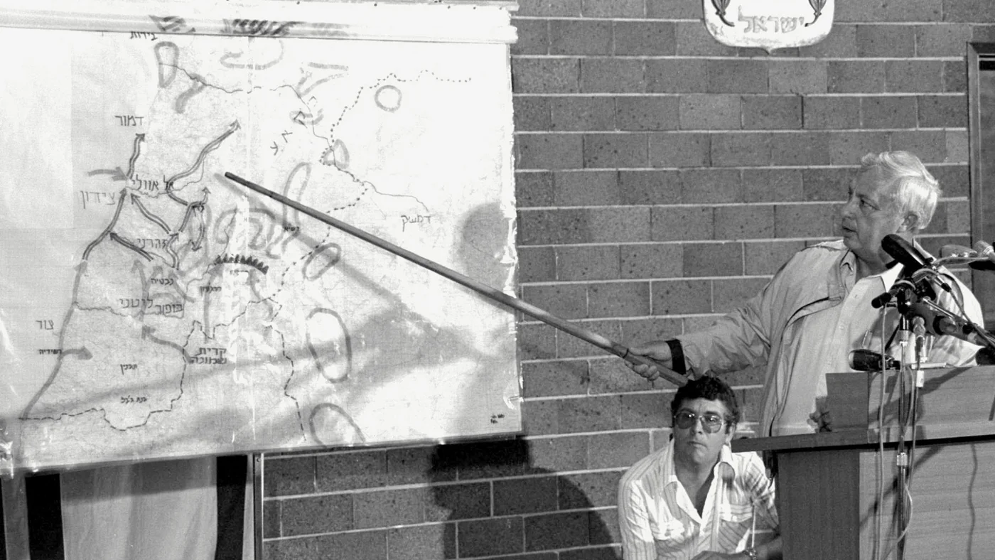
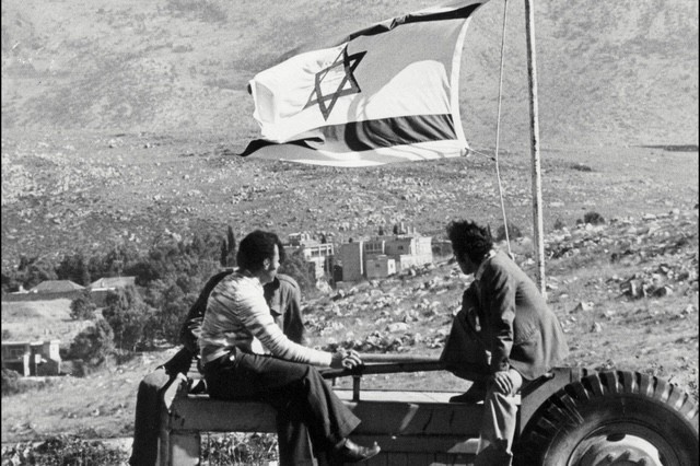
The occupied farms were: Al Qusayr, Alman, Sarda, Amra, Hamames, Al Mseisat, and Al Bouwayda.
In Nabatieh District, Israel occupied two villages: Yuhmor al Shaqif and Arnoun, as well as two farms: Ali al Taher and Hima Arnoun, in addition to a number of hills overlooking the city and Israeli settlements.
In Bint Jbeil District, Israel occupied 18 villages and towns, namely:
Bint Jbeil, Ainata, Aitaroun, Maroun al Ras, Yaroun, Beit Yahoun, Kounine, Al Tiri, Ain Ebel, Rmaish, Hanin, Debl, Qaouzah, Beit Lif, Rashaf, Srobbine, Ayta ash Shaab, and Ramiyah.
In addition, there were four uninhabited farms: Al Salhani, Samouqa, Jbab al Arab, and Dweibeh.
In Hasbaya District, the number of villages occupied before 2000 reached 13 villages and 7 farms. They were:
The villages: Shebaa, Al Hebbariyeh, Kfar Shuba, Kfar Hamam, Rashaya al Foukhar, Hasbaya, Kawkaba, Shwayya, Ain Qiniya, Ain Jarfa, Fardis, Al Mari, and Abu Qamha.
The farms: Al Majidieh, Halta, Barghaz, Ghajar, Al Nakhileh, Mazraat Salib, and Dhiraj.
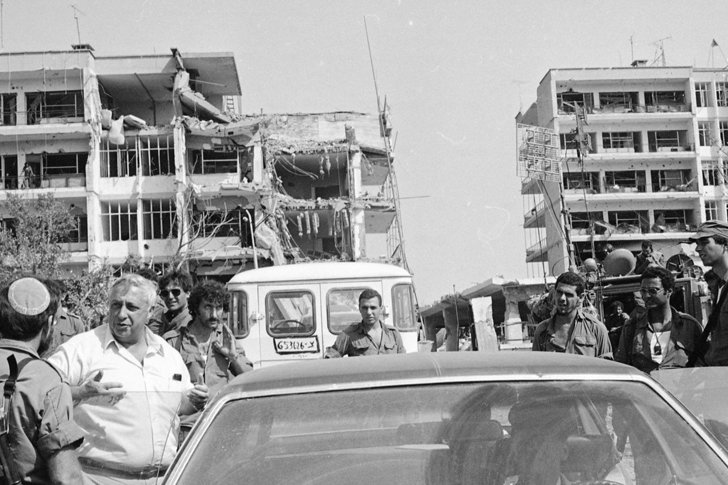
In Jezzine District, the area was incorporated into the occupied border strip during the 1982 invasion. The occupied villages and towns were:
Jezzine, Al Aishiyyeh, Al Rihan, Aaramta, Kfar Hounah, Roum, Aazour, Anan, Safarieh, Kfar Falous, Bkassine, Arni, Bahnin, Bteddine al Loqsh, Benwati, Bisri, Haitoura, Haidab, Qatteen, Haitouleh, Al Homsiyeh, Al Qatrani, Al Sirira, Ain Majdalain, Al Harf, Sineh, Sabah, Saydoun, Al Qabatiyeh, Al Maknouniyah, Maydan, Wadi Jezzine, Al Baba, Ain al Mir, Mashmousheh, Sajed, Al Jarmaq, and Rimat.
The occupied farms were:
Baanoub, Mazraat al Matḥanah, Darya, Damashqieh, Dalfani, Kharkhiyeh, Rummaneh, Rahban, Aleima, Shamkha, Arabiyeh, Aaqmata, Qbai, Houraniyeh, Qrouh, Harf al Dqiq, Zghrine, Waziyeh, Mahmoudieh, Kfar Teqla, Mazarae Mawtiyeh, and Wardieh.
It should be noted that the Israeli army, together with the South Lebanon Army, withdrew from some villages in the district in May 1999.
Changes between the two periods
The map of the occupied area in southern Lebanon changed between the periods before 2000 and 2026. Jezzine District is no longer occupied today, while Israel has reoccupied almost the same villages in the districts of Tyre, Bint Jbeil, Marjayoun, and Nabatieh.
In Hasbaya District, however, the situation is different, as most of its towns remain outside the occupation, from Ibl al Saqi to Hasbaya. Israel maintains fire control over the villages of Arqoub, where a number of residents remain, noting that the sectarian demographic structure of this district differs from that of the other districts.
It appears that the occupation of Khiam, the last Shiite city in the eastern sector, has separated Hasbaya District from Marjayoun and even separated the Western Beqaa area from the south, as Israel controls the entire area through fire control and dominance from the heights of Mount Hermon.
The new Israeli occupation map shows a significant difference compared with the previous one. The area occupied today is approximately 650 square kilometres, whereas previously it covered around 1,350 square kilometres. Israel has turned the villages into uninhabitable areas.
Before 2000, Israel established Khiam Prison, but today it has demolished it and turned it into a base for Israeli tanks. While it previously worked to create the South Lebanon Army, it now occupies villages without inhabitants and prevents residents from returning and rebuilding them. This raises questions about the future of the occupied strip and the possibility of liberating it again, after the Lebanese waited 22 years for the end of the occupation in 2000.
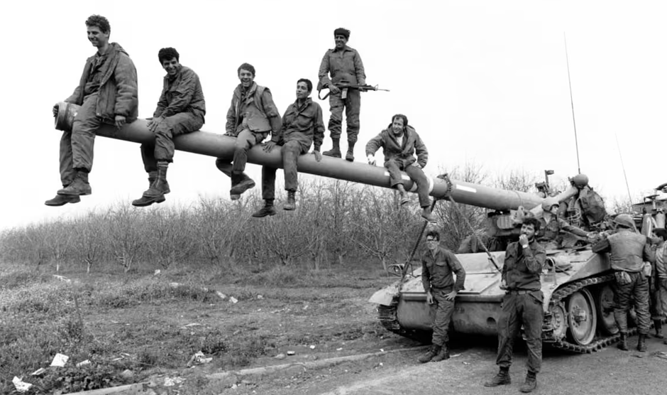
Israel occupied 55 villages and towns in southern Lebanon, reaching a depth of between 6 and 10 kilometres, and incorporated them into the Yellow Line. It then expanded its fire control over more than 11 towns, which it now controls.
Before 2000, Israel occupied 171 towns, farms, and villages, an increase of 112 compared with the number occupied in 1978.
Disclaimer: The opinions expressed by the writers are their own and do not necessarily represent the views of Annahar